
CRIME MAPPING AND GEOGRAPHICAL CRIME ANALYSIS
Definition: GIS
A geographic information system (GIS) is a powerful software tool that allows the user to create any kind of geographic representation, from a simple point map to a three-dimensional visualization of spatial or temporal data.
A GIS is a set of computer-based tools that allows the user to modify, visualize, query, and analyze geographic and tabular data.
A GIS is similar to a spreadsheet or word processing program in that the software provides a framework and templates for data collection, collation, and analysis, and it is up to the user to decide what parts of the system to use and how to use them. A GIS does more than enable the user to produce paper maps; it also allows him or her to view the data behind geographic features, combine various features, manipulate the data and maps, and perform statistical functions.
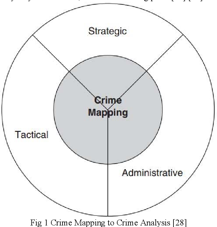
Definition: Crime Mapping
Crime mapping is a term used in policing to refer to the process of conducting spatial analysis within crime analysis. Crime mapping is the process of using a geographic information system to conduct spatial analysis of crime problems and other police-related issues.


Download Files
- INTRODUCTION TO APPLIED CRIMINOLOGY
- ROLE OF CRIMINOLOGIST IN CRIME PREVENTION
- AREAS AND INSTITUTIONS
- THE ROLE OF DETECTIVE AGENCY
- ROLE OF FORENSIC LABORATORIES
- RESTORATIVE JUSTICE AND VICTIM – OFFENDER’S MEDIATION
- Strategies and Approaches
- PROBLEM SOLVING POLICY
- Community-Oriented Policing
- PROBLEM-ORIENTED POLICING (POP)
- CRIMINAL INVESTIGATION ANALYSIS
- CRIME MAPPING AND GEOGRAPHICAL CRIME ANALYSIS
- ROLE OF CITIZEN POLICE LIAISON COMMITTEE (CPLC) IN CRIME PREVENTION
- FORENSIC EVIDENCE AND JUSTICE SYSTEM
- IMPLICATIONS
- Community Protection
- Society Protection
- Professional Justice for Inmate
- CRIMINOLOGY AS CRIME SOLVING SCIENCE
- PROFESSIONAL RESEARCH
- Chapters 20
- Department Sociology and Criminology
- Teacher
Ms. Saima Manzoor
